
Not far from Abilene, Texas and passing through Sweetwater there are hundreds and hundreds of wind generators. This is just a few that we saw.

The Odessa Meteor Crater in Texas is suppose to be the second largest in the USA. The next photograph will show the extent of this 500 feet diameter crater

We have seen bigger "dunny" holes in Australia than this crater. It was really disappointing. It is located at Odessa which is located smack in the middle of oil well country. According to the signs there are many rattlesnakes in this area - we didn't see any!

We were worried that "Ralph" had a fuel leak going through Odessa, Texas. The smell was almost like diesel but strangely different. Actually the smell was crude oil and permeates the air in this part of Texas

Yes - it's 80 MPH which is 124 KPH in our language. taken along the I-20 near Midland, Texas. When traveling at 80 MPH the road was so good it felt like driving at 80 KPH.

The bottom left notation of this GPS reads the vehicle is traveling at 106 MPH on a 80 MPH highway! Damn Mustangs has that much power it's easy to go into warp speed
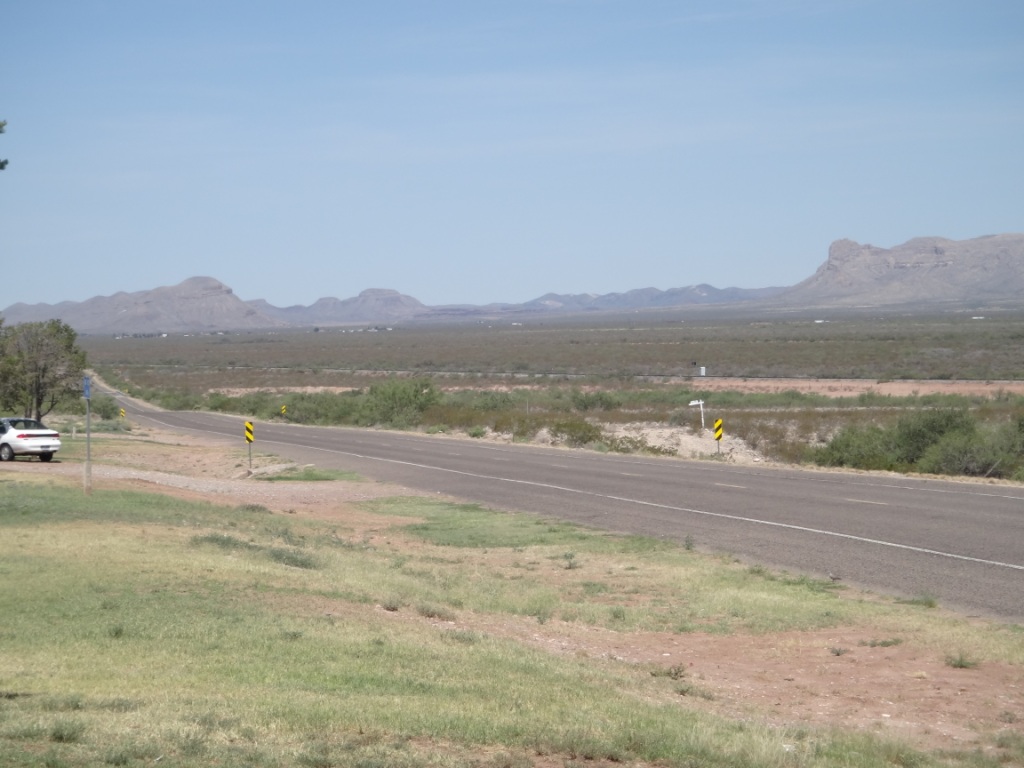
Along the I-20 near Van Horn in Texas. It is desert with those mountains in the background almost dividing USA with Mexico

Ralph waiting for its occupants to finish lunch at a rest area along the I-20, near Van Horn, Texas

When entering El Paso in Texas the highway follows the border with Mexico. The fences in this picture is part of the miles and miles of separation between the two countries

This monstrosity is in Mexico in Cuidad Juarez. We think it represents the border crossing near the Rio Grande. Taken from El Paso, Texas

We ascended Ranger Peak via the Wyler Aerial Tramway in El Paso. At over 5,000 feet it fords a 360 deg view of El Paso, Mexico and New Mexico. In this photograph below is the dividing line of USA and Mexico. The city in Mexico is Cuidad Juarez which has a claim to be the most dangerous city in North America. Murders occur in the hundreds per week.

Somewhere down there is our hotel and the border of New Mexico. Taken from Ranger Peak, El Paso, Texas

The city of El Paso is well spread out along the Rio Grande. Taken from Ranger Peak, El Paso, Texas

The biggest USA military base is Fort Briggs - and it's growing. The vacant land in this photograph from Ranger Peak, El Paso is just the beginning of the land reserved for the Army and Air Force base.

This view from Ranger Peak is Cuidad Juarez in Mexico. What we have seen of this city through the wire border fence is shanty houses and run down adobe style structures.

Descending down Ranger Peak in the Wyler Aerial Tramway in El Paso, Texas

Not far from our hotel in El Paso are these wind generator propeller blades - they are huge.

The Mexican border at Santa Theresa. Taken on the New Mexico side

Crossing the Rio Grande near the Texas and New Mexico border north of El Paso

A Texas delight - ribs, beans, corn, broccoli and catfish strips. Our last dinner in Texas in a B-B-Q restaurant in El Paso
We left Abilene at 7 am this morning and with an extra hour after changing time zones we made it to El Paso at 1:30 pm. It was 440 miles and the 7.5 hour journey wasn't that bad. We could travel at 80 MPH and watch the scenery change from cattle farms to desert. We did stop at a place called Odessa to check out USA's second biggest meteor crater. It was only a shallow depression and hardly noticeable that it is a crater - rather disappointing we thought. At this point we got worried that Ralph was emitting fuel. The smell was strong and discovered that the numerous oil wells in this area caused the air to emit a diesel like odour. Continuing on we left the I-20 interstate highway and joined the I-10. This highway is the US's longest interstate road, starting from LA to Florida. We actually used this highway back in New Orleans and will now use this road to travel to Phoenix, Arizona. When we reached El Paso we followed the border between Mexico and the US. High fences separates these countries. What we saw through the fence is a large city with structures that appear in poverty. We made our way to the Wyler Aerial Tramway and ascended Ranger Peak for a great view of El Paso. Our hotel is on the north side of El Paso and after check-in we drove to the New Mexico side of the Mexican border for a photograph. This involves crossing over that famous river the Rio Grande. Tomorrow we have our last day traveling and will make it back to Phoenix, Arizona where we first started 49 days ago. Time does fly fast. We don't have to hand in Ralph until Sunday morning so hopefully we will hold Ralph the Mustang in the hotel's parking area. On the way to Phoenix we hope to stop at Tucson and visit the Old Western Studios where many TV and films were and still are made. Like, Gunsmoke, Bonanza, Rio Lobo etc etc etc. So that's it for today and cheers to all.
Oh, I know this drive too well. May I use your photo of the speed limit sign for an upcoming blog post? I will link back to this post. Thank you!
ReplyDeleteNo problems in using any photos within this blog. There is no need to link back to this post. Cheers, Neil & Anne.
ReplyDelete